News
Future of cave mapping on the Abaco Blue Holes with National Geographic
Dec
Sebastien Kister is a french cave diving instructor sharing his passion for the cenotes of the Riviera Maya in the Yucatan Penninsula with students from around the world. He applies his software engineer background in the development of software and measurement instruments aimed at making the underwater tasks of his fellow cave explorers and surveyors easier.
Planning the dive! Preparing the equipment, gearing up! Exploring underwater caves! Laying line! Diving, diving and diving again! Any cave diver is thrilled at the idea of any of those steps, the common parts of our underwater explorer life. But when it comes to surveying or mapping a cave, enthusiasm is not usually the first emotion that comes to our minds. Surveying Is a time consuming occupation that requires a high level of focus while it is done. It can only go wrong … between parallax errors while reading the compass, to errors in estimating or measuring the length of the line, to the too common errors done while recording the data on the slate. To make it worse, getting a quick visualization of the data requires mastering software that is far from user friendly for the average non-geeky cave diver.
These evils were the ones facing any good willing cave surveyor at the beginning of my professional cave instructor career in 2011. I decided to develop Ariane, a cave mapping solution, in an attempt to make surveying and mapping more accurate and user-friendly for cave divers. The software was initially tested in the field during the exploration of the Doggi cave system with the Q.D.T team in Mexico. This expedition collected nearly 20000 feet of data and allowed me to quickly tailor Ariane’s features to exactly what the cave explorers needed. After 5 years of work on Ariane, I have the satisfaction of seeing it used for mapping the caves in Abaco during this National Geographic project.
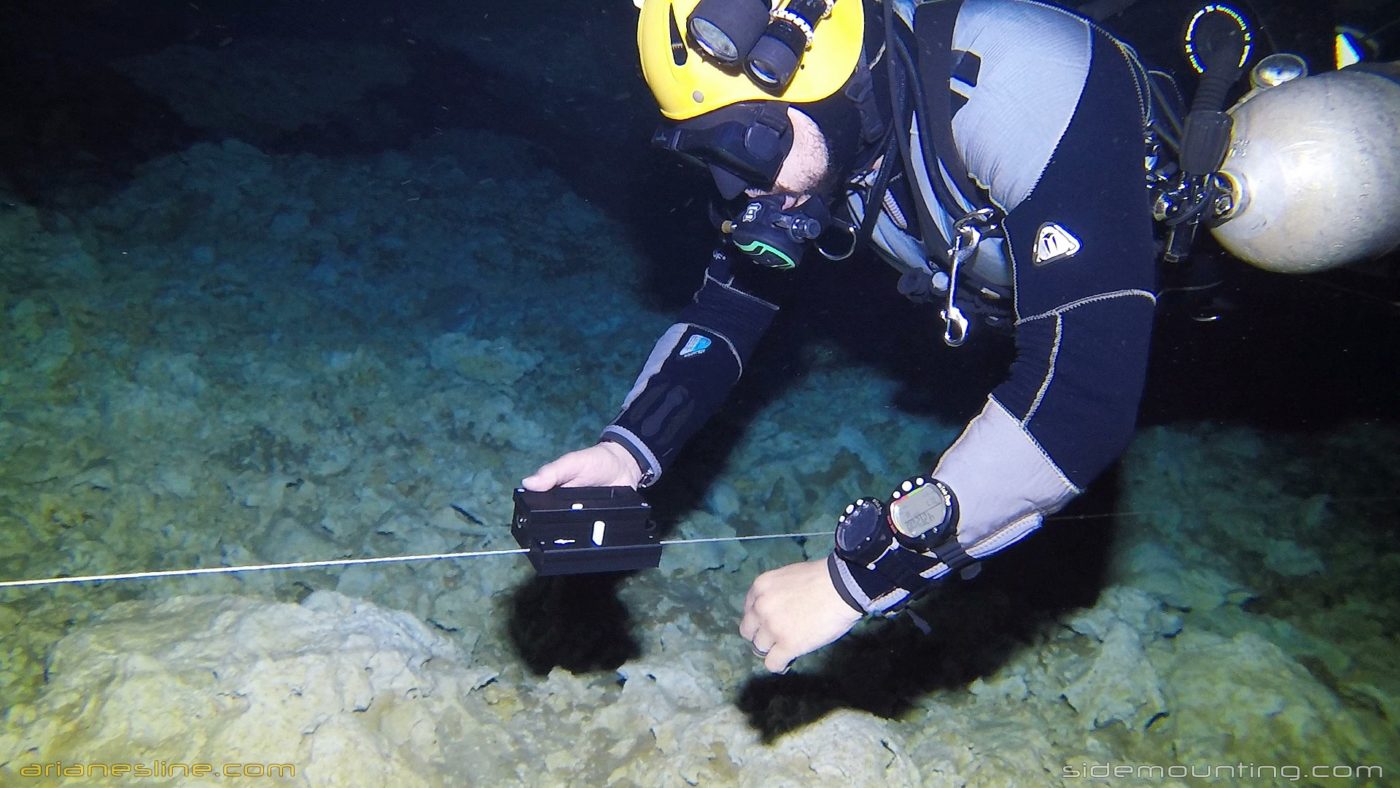
Having taken care of Charybdis, the software part of cave survey, only Scylla, the actual measurement of the line in the cave, was left. That’s where Mnemo comes in. The result of a year of development and testing, Mnemo is a small handheld device that records all the parameters necessary to survey a cave line: depth/Inclination, length of the line and azimuth. In order to not effect the safety and cave awareness of the diver, I designed Mnemo to require as little attention as possible from its user, the actual contrary of what traditional slate/compass survey requires. Mnemo slides along the cave line collecting this data, using only one cursor and easily visible colours to control and signal the survey events.
The second evil was thus taken care of: surveying a cave line is now (nearly) as easy as swimming along it! Some of the explorers were given the opportunity to test the unit here in Abaco. and the beginning section of Ralph’s cave was surveyed both by hand (by Brian Kakuk) and with MNemo (operated by Sebastien Kister) yielding only a 1.8% difference. During the time the survey was done by hand it could have been done 5 times with MNemo
Credit Intotheplanet